Searching for Underwater Oil Locations
To find oil underwater, researchers conduct seismic surveys to determine “what lies beneath.”
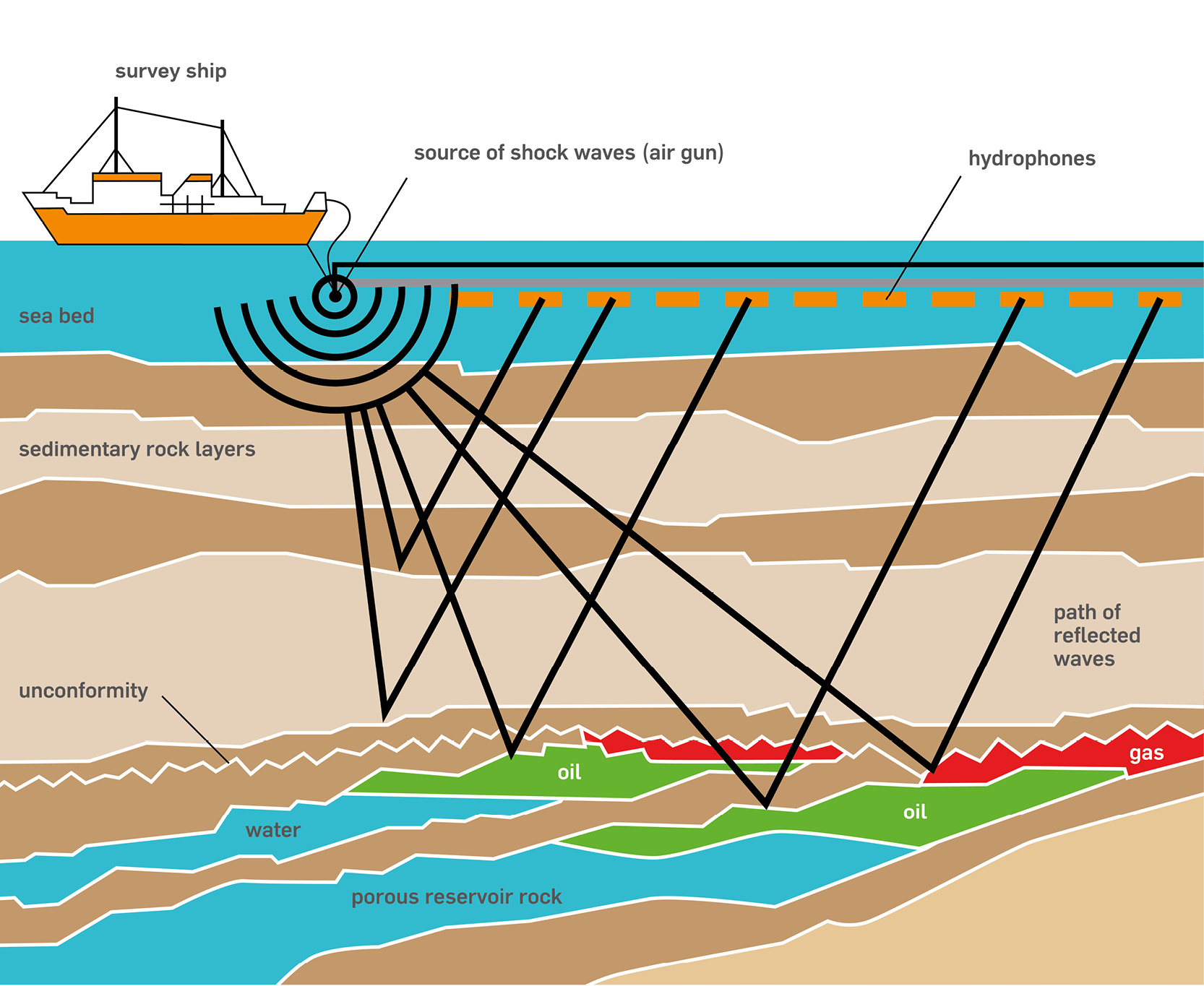
To do this, they transmit an energy signal—sometimes via an airgun—which puts a shock wave (or pulse) in motion.
As the shock wave (pulse) travels underwater, it encounters rocks, ledges or other below-water formations. Different types of formations reflect sound differently.
Receiving devices, called hydrophones, record how fast and how loud the sound is reflected from the below-water formations. This helps experts to decide whether there might be oil under the water’s surface.
In this image we see a two-dimensional (2-D) seismic survey at work. It is two-dimensional because the hydrophones are in a straight line.
If the hydrophones were laid-out in a grid, it would be a three-dimensional (3-D) seismic survey.
Click on the image for a full-page view.
 AwesomePrint